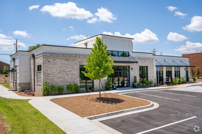
Property Record
250 Applewood Dr, Lawrenceville, GA 30046


NEARBY LISTINGS FOR SALE OR LEASE
Property Detail
250 Applewood Dr
Atlanta-Sandy Springs-Roswell, GA
Cooper Est
5-148-004
LOTS 9, 10, 11, & PARCEL 1 GRAYSON HWY - PB153-226
Taxexempt
Gwinnett
X
Georgia
13135C0089F
9-11
0
9.71 AC
2025
Outer Gwinnett County
050522
Atlanta
220,161 SF
DEMOGRAPHICS near 250 Applewood Dr
1 mile
3 mile
5 mile
2024 Total Population
8,746
75,517
192,832
2029 Population
9,183
78,708
201,185
Pop Growth 2024-2029
+ 5.00%
+ 4.23%
+ 4.33%
Average Age
37
37
37
2024 Total Households
3,027
24,247
60,984
HH Growth 2024-2029
+ 5.12%
+ 4.37%
+ 4.43%
Median Household Inc
$47,448
$67,907
$81,817
Avg Household Size
2.80
3.00
3.10
2024 Avg HH Vehicles
2.00
2.00
2.00
Median Home Value
$313,807
$296,973
$295,806
Median Year Built
1984
1997
1996
Nearby Places
Map Layers
Map Styles
 Street
 Aerial
Transit
 Traffic
 Biking
Places
Listings with unknown addresses are not visible on the map
- Restaurants
- Banks
- Shops
- Fitness
- Groceries
Nearby Properties
Address
Land Use
TOTAL SIZE
Lot Size
Zoning
Address
Land Use
TOTAL SIZE
Lot Size
Zoning
1,218,930 SF
66.65 AC
OI
Address
Land Use
TOTAL SIZE
Lot Size
Zoning
1,276,197 SF
91.78 AC
OI
Address
Land Use
TOTAL SIZE
Lot Size
Zoning
1,071,116 SF
69.77 AC
OI
Address
Land Use
TOTAL SIZE
Lot Size
Zoning
939,709 SF
159.36 AC
RS180
Address
Land Use
TOTAL SIZE
Lot Size
Zoning
275,917 SF
13.34 AC
BG
Address
Land Use
TOTAL SIZE
Lot Size
Zoning
484,262 SF
34.27 AC
RM
Address
Land Use
TOTAL SIZE
Lot Size
Zoning
493,520 SF
12.67 AC
BG2
Address
Land Use
TOTAL SIZE
Lot Size
Zoning
321,476 SF
38.63 AC
RMM
Address
Land Use
TOTAL SIZE
Lot Size
Zoning
16,062 SF
89.78 AC
BG
Address
Land Use
TOTAL SIZE
Lot Size
Zoning
812,946 SF
82.22 AC
BG2
Address
Land Use
TOTAL SIZE
Lot Size
Zoning
641,171 SF
43.12 AC
RM13
Address
Land Use
TOTAL SIZE
Lot Size
Zoning
190,485 SF
103.66 AC
RA200
Address
Land Use
TOTAL SIZE
Lot Size
Zoning
439,272 SF
18 AC
RM24
Address
Land Use
TOTAL SIZE
Lot Size
Zoning
360,279 SF
13.16 AC
RM24
Address
Land Use
TOTAL SIZE
Lot Size
Zoning
298,990 SF
24.16 AC
RM12
Address
Land Use
TOTAL SIZE
Lot Size
Zoning
333,734 SF
24 AC
BG
Address
Land Use
TOTAL SIZE
Lot Size
Zoning
271,668 SF
20.13 AC
RM13
Address
Land Use
TOTAL SIZE
Lot Size
Zoning
279,207 SF
19.14 AC
RM13
Address
Land Use
TOTAL SIZE
Lot Size
Zoning
325,459 SF
21.18 AC
HM
Address
Land Use
TOTAL SIZE
Lot Size
Zoning
221,082 SF
12.90 AC
RM24
Address
Land Use
TOTAL SIZE
Lot Size
Zoning
201,000 SF
29.98 AC
R75
Address
Land Use
TOTAL SIZE
Lot Size
Zoning
213,116 SF
15.09 AC
RM12
Address
Land Use
TOTAL SIZE
Lot Size
Zoning
286,368 SF
34.55 AC
R75
Address
Land Use
TOTAL SIZE
Lot Size
Zoning
278,350 SF
35.62 AC
C2
Address
Land Use
TOTAL SIZE
Lot Size
Zoning
240,509 SF
19.18 AC
RM
Address
Land Use
TOTAL SIZE
Lot Size
Zoning
175,190 SF
11.17 AC
RM
Address
Land Use
TOTAL SIZE
Lot Size
Zoning
231,373 SF
3.82 AC
OI
Address
Land Use
TOTAL SIZE
Lot Size
Zoning
270,396 SF
4.57 AC
OI
Address
Land Use
TOTAL SIZE
Lot Size
Zoning
571,230 SF
64.70 AC
LM
The World's #1 Commercial Real Estate Marketplace
Connect with us
© 2026 CoStar Group
The information above has been obtained from sources believed reliable. While we do not doubt its accuracy we have not verified it and make no guarantee, warranty or representation about it. It is your responsibility to independently confirm its accuracy and completeness. Any projections, opinions, assumptions, or estimates used are for example only and do not represent the current or future performance of the property. The value of this transaction to you depends on tax and other factors which should be evaluated by your tax, financial, and legal advisors. You and your advisors should conduct a careful, independent investigation of the property to determine to your satisfaction the suitability of the property for your needs.